Wednesday, January 31, 2007

from battlefield to babes

january 30, 2007

So here we are on the flanks of historic Signal Hill - a designated National Historic Site - an iconic place for most Newfoundlanders (and recently
voted best place to make out and, well, also best place to splitzo) and one that tops the must-visit list of tourists. The proposed redevelopment of the Battery Hotel galvanized residents in 2005 when a developer wanted to build a 10-storey brute of a building. That developer, Rick Butler, has since purchased the hotel, painted part of it red and added this life-size poster to one side. As one resident has put it:

"Rick Butler now owns the [Battery] hotel...and that sign on the side is scaring the hell out of me. . . he thinks he is still inCalifornia. Next week there will be valets on roller skates . Maybe avisit in February will remind him where the Battery is . Talk about a cultural slap in the face! That sign is a HUGE warning of this guy's mentality and how unaware he is. "

Just hope this babe doesn't try doing that in St. John's harbour - she could hit a nasty bubble.

On the victory side, residents of Quidi Vidi - just the other side of Signal Hill, have won a victory over further inappropriate development in their historic village.

Monday, January 29, 2007

cabin fever?

(photo taken at little heart's ease, by john knight)


january 29, 2007

you know when my kids - especially #2, the son - start jumping around the house it's time to chuck them outdoors. go build a snow fort-shovel snow-put out the compost-sled down the neighbours back garden-look for flickers, whatever. goodness knows what my excuse is.

snow is continuing in st. john's. cabin fever could be setting in.

Sunday, January 21, 2007

Newman Sound


january 21, 2007

The three of us were out to feast our eyes on the wild blue - a field of wild irises, that is. The July 1st weekend should have put us there - in Newman Sound in Terra Nova National Park - at the right time (see my story in Kanawa, summer 2003). As it turned out, we were a couple of days early, the lips were barely opened. But we found a rich intertidal environment brimming with comb jellies, starfish, limpets, sea urchins and anemones grouped like baked apples on a platter, all in a garden of gold rockweed and other seaweeds. And good swimming (okay, not in the ocean but found a couple of clear ponds to bathe in), great back country camping (complete with much-needed bear hangers), and an old deserted community to wander around (Minchin's Cove is still full of slab wood and rusty engine parts from an old sawmill, a few graves and root cellar depressions from the former community).


Wednesday, January 17, 2007

Ragged Harbour & the brass button man


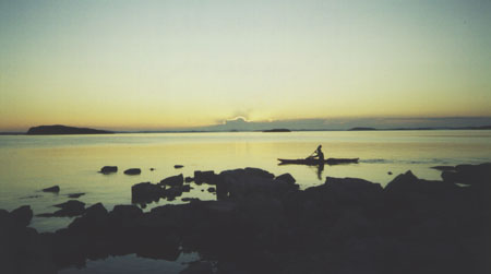
july 2002 I took the family on a road trip 'all around the circle' like the song. One of our first stops was at the cabin of a friend, well-known musician Eric West. His little cabin in Ragged Harbour is but a 15-mins drive from his home in Ladle Cove on the straight shore. Across from Fogo Island. Well, it's too hard to describe to those not familiar with Newfoundland but suffice to say it's pretty rugged by even Newfoundland standards. Bakeapple-bog flats behind, cold ocean beyond - I was standing on a thin wedge of terra-maybe-firma.
Anyway, Eric graciously loaded us up with goods from his freezer - moose, caplin, greens, his mum's homemade bread, cake, squares. We were good. I squeezed the car over the mussel-laden dirt road and it farted to a stop in front of his emerald-green cabin. Kids piled out and quickly got a beach fire started for dinner. That night Eric joined us and we sat in the dark as he played guitar, enthralling the kids with his many songs including the 'Brass Button Man' - a song that sent gleeful shivers down the kids' backs as they thought about this strange fellow on Duck Island - not far from where we were now staying.
Eric is also a paddler, and we'd planned a couple of day paddles. The wind had other plans so we kept our kayaking and canoeing short in the sheltered reaches of this bay.
But Ragged Harbour left its imprint on me. And the few days spent there - watching the kids make inukshuks on an island at low tide, eating meals on the rocky beach, and revelling in thunderstorm backlighting the tuckamore - turned into a short story, 'Products of Erosion ', that was published last summer in The Nashwaak Review.

Tuesday, January 16, 2007

KNL's Annual Retreat

january 17, 2007

The May 24th Weekend. It's a big one in Newfoundland. I'm certain in other places they're raising a glass to Queen Victoria. But here for many folks it's about pitching a tent (or parking in the RV) in a provincial park and enjoying a few beers with friends. Not my cup of tea but each to her own. For paddlers, it means a weekend based out of cabins in Traytown near Terra Nova National Park; the opportunity to paddle the ocean or rivers, take a stroke or river-running clinic, participate in a day paddle with new and old paddling buddies, enjoy a cold beer at the end of the day, throw a frisbie, dance in the pub on saturday night, take in a banquet dinner with a guest speaker (fab kayakers like Justine Curgenven and Ruth Gordon) sunday night, and wake up hungry monday morning while the KNL board of directors cooks up an open-air pancake breakfast.

Yeah, cold days like this I'm looking forward to this May 24th - Kayak Newfoundland & Labrador's 7th Annual Retreat. About 100 paddlers of both sea and WW persuasion come out to the retreat. The location is ideal: two rivers nearby offer great WW runs and where they spill out to the ocean, offer the opportunity for sea kayakers to practise some moving water skills. And the rocky coastline is riddled with bays, coves, arms, inlets and fjords aligned in different directions so there's usually somewhere to paddle even when it's blowing. It may snow, rain, hail (paddled in all three one year) or be blistering hot. And if it's really too windy to paddle, well there's lots of hiking trails to go on in the nearby national park.

Thursday, January 11, 2007

habits of mating murres and other quandaries


january 11, 2007


So, when you say they’re monogamous, is it a year-round commitment?

Seabird biologist and Canadian Wildlife Service research scientist Greg Robertson didn’t get his feathers in a flap for this (“no, it’s a summer romance”) or any of the other more, well, scientific questions put to him at tonight's lecture, the first of KNL’s 2007 winter series, entitled “bull-birds, tinkers and turrs.”


An entire colony of paddlers turned up to learn about Newfoundland seabirds, their ecology and how to tell them apart. I was fascinated by the talk – and the continuing bombardment of questions from the floor – and learned a whole lot more about species population, trends and problems (e.g. which species are more susceptible to oil spills, ghost nets, hunting, etc.).


And it turns out, kayakers can be hazardous to many of these marine birds. Kayaks allow us to get close to a cliff-dwelling colony without being detected - at first – but chances are a flock of startled seabirds could fatally dislodge their eggs from nooks and crannies. I was startled to learn just how few eggs most of these species lay (1 or 2). Just a few paddles by a few kayakers to an island or cliff colony at the wrong time of year could potentially decimate a local population. Something to think about. Greg suggested approaching islands straight on rather than surprising any nesting birds, and not to lunch at any bird breeding islands. Well, that makes sense. Small things we kayakers can do to help the survival of our feathered friends on the water.


At the same time, the coastline of Newfoundland offers kayakers a marvellous opportunity to observe seabirds - from an appropriate distance. Every year, millions of seabirds travel here.

In the autumn, many come here from the high Canadian arctic and Greenland. In the spring, swarms of them cluster in the bays and along the coastline (Artic terns, for example, arrive after a lengthy trip from Antarctica). Over the spring and summer it's possible to see gannets, murres, guillemots, kittiwakes, herring gulls, black-backed gulls, puffins (the province is home to about 95 per cent of the continent's Atlantic puffins), razorbills, loons, eider ducks, cormorants, bald eagles, ospreys, the list is near endless. Way more than I know.


Above photos: top one is Cape St. Mary's (from Cackle TV) - humungous gorgeous hunk of rock seething with birds on the southern Avalon, Newfoundland - easily accessible by foot - includes one of the largest Gannet colonies in the world. Other two are from website of Dr. Bill Montevecchi, a University Research Professor of Pyschology, Biology and Ocean Sciences at Memorial University of Newfoundland. Hope he doesn't mind my using them!

Wednesday, January 10, 2007

Circumnavigating Bell Island


january 10, 2007

Circumnavigating Bell Island can be a challenging paddle, particularly around the northern end when there's a good swell on and northerly winds. Just happened to be the case the day I paddled it with friends back in '03. I'd been out on a night paddle the evening before. Got home around 2am to a phone message 'we're paddling around Bell Island tomorrow - meet us at the ferry at 9am if you're interested'.

Well, of course I was, and what's a little lack-of-sleep. It was Regatta Day (so several people had the day off from work), sunny with some clouds. Winds started at 20km NW. We loaded up our boats after taking the 20mins ferry ride and at 10:30am headed north for a counter-clockwise circumnavigation (about 26km if I recall). Hit with swells of about 8ft with chop around the north head of the island - this is the challenging spot, there's a nasty shoal at one side, sheer cliffs and no take-out for about 2 hrs from the put-in. We gave the breaking shoal a wide birth, then surfed into a beach for lunch - one member who's a terrific paddler got seasick on this first stretch - and an hour-plus lay-down after clambouring through a mining tunnel and up onto a meadow. Geology of Bell Island makes a fantastic paddle - cathedral cliffs worn in folds like curtains, sea caves, massive sea stacks. The mesa-like sandstones of Bell Island are an anomaly in this Avalon region of mainly granite and shales.

While we surfed a good part of the western side on following seas, by the time we made the southern end it was dead calm. Rounding the end and paddling up the eastern side, the winds had changed to NE (isn't that always the way) but they weren't much to bother about. We were off the water shortly after 5pm - except for Mark D who poo-pooed the ferry and paddled over from the 'mainland' and back! I was paddling with some of Newfoundland's finest paddlers, had challenged myself to go beyond my comfort level - and went home feeling great.

The following excerpt is from Geological Guide to Newfoundland & Labrador:

Bell Island is close to the city of St. John's, and yet it represents a separate world with its own interesting mining history. The ferry to Bell Island runs about every 45 minutes from Portugal Cove, and the trip makes a pleasant day outing. A useful billboard map of the island stands at the bottom of the steep hill at the ferry terminal on the island.

The beach area immediately north of the ferry terminal is backed by high cliffs of Ordovician shale and crossbedded sandstone, appropriately called the Beach Formation. These rocks were formed in an ancient tidal environment where a variety of animals lived. Signs of these animals may be seen in trilobite tracks, worm burrows and shell fragments on the flat surfaces of fallen slabs.

Drive on up the steep hill from the wharf, turn right on East End Road, then right on Lighthouse Road to visit the lighthouse at the north end of the island. Park at the barrier and look east at the cliff face on the large detached block. The same reddish, gently dipping beds seen on the beach are present below, overlain by a band of grey, quartz-rich sandstone.

Proceed back along Lighthouse Road, turning right at East End Road, and follow it into the town of Wabana. Several large murals on public buildings depict scenes from Bell Island's history. The oldest open-pit iron mine, opened in 1895, lies off to your right as you drive straight through the town. Surface ore ran out in 1902, and mining descended underground, following the west-dipping, iron-rich layers as far as 3 km out under Conception Bay toward Carbonear. Beyond the west end of Wabana, just before the Trade School and another mural, Airport Road branches right. A short distance down it, to the right, is the entrance to one of the inclined shafts, dating from 1916. The iron mines eventually closed in 1966.

Lance Cove, on the southeast side of the island, was first settled by farmers and fishermen in the early 1700s.


Other beautiful photographs of Bell Island, from clifftops, available here.

Sunday, January 07, 2007

out with the old


january 7, 2006

... in with the new.

And so we bid adieu to the twelve days of Christmas. (And son Ezra's tooth.) No snow yesterday, old Christmas Day, so we went biking. Imagine! And our tradition of burning Christmas trees in a big bonfire at Middle Cove Beach (we grab trees tossed aside on the streets of St. John's, ours stays up for quite a while yet) was likewise rained out. However, I enjoyed a fabulous 12th night party at a friend's place in the Battery - just around the corner from me - with lots of musicians to cheer in a new year.

Friday, January 05, 2007

Memories of Woody


January 5, 2007

Woody Island, Placentia Bay. It conjures up a bunch of thoughts. Jim Price and lodge owner Loyola Pomeroy organize the annual kayaker's weekend there in April. They even have a boat to follow the paddlers and bring them lunch! But Woody also makes a great day-paddle in the summer.
From the put-in at Garden Cove, it's leisurely 2-3 hour paddle to this resettled island. (And if you call Loyola ahead of time, you can order lunch - complete with toutons - at Woody Island Resort.) Oh, that's Sound Island, across from Woody, in the photo directly above and the Burin Peninsula in the background. Nice lumpy land, lots of wildlife (always eagles, usually a caribou or two, river otters playing in the inner reaches). Nearby at Rattling Brook there's a deep pool above a small waterfall - ideal for a mid-paddle refresher. On the outside of these two islands, one can see clear across the Placentia Bay (well, usually one out of three days) and often see huge oil tankers making there way to and from the Grand Banks glory holes.


Placentia Bay, on the south coast of Newfoundland, is a huge, ice-free deepwater bay. It's fringed with outports full of people with surnames of the original settlers and scudded with over 300 islands including Woody. A paddling paradise.


Tuesday, January 02, 2007

New Year's Dip


(photo credit: jamie lewis)
january 2, 2007

Quidi Vidi Gut, New Year's Day. The ritual paddle (if you can call it that) was started years ago by veteran paddler Jim Price (who just happened to be down south this time). A number of us regularly turn up to this small harbour, just minutes from downtown St. John's, and scoot down the icy slipway to celebrate the new year in a proper fashion - on the water.

Quidi Vidi, an historic village first settled in the 16th century and now within the City of St. John's boundary, had retained its appearance for centuries. It still has narrow winding lanes, fishing sheds, old buildings and lots of charm but developers are eagerly gobbling that up by building massive, architecturally-inappropriate homes on and near the waterfront. Geesh, you'd think we'd learn by now that the value resides in what we have and are, not someone else's idea of us.

Okay, back to paddling. It was chilly (ice kept forming on our decks & spray skirts) and a northerly wind gusting upwards of 50km kept a balmy -4C to feeling around -11C. Not cold enough to keep fellow paddler Peter A from trying out his new drysuit by executing a quick roll.

Fellow paddler and blogger Jamie Lewis also has a couple of reports on the day promised. My underwater camera was on the blink so I have none from the day - hopefully Jamie will blog his soon and have shot of the entire gang and harbour.

Tuesday, December 26, 2006

the passion of travel

december 26, 2006

"It is not down in any map; true places never are."
- Herman Melville, Moby Dick.
[opening quote to Miles Harvey's The Island of Lost Maps, published by Broadway]

"What is life but a form of motion and a journey through a foreign world? Moreover locomotion - the privilege of animals - is perhaps the key to intelligence. The roots of vegetables (which Aristotle says are their mouths) attach them fatally to the ground, and they are condemned like leeches to such up whatever sustenance may flow to them at the particular spot where they happen to be stuck... In animals the power of locomotion changes all this pale experience into a life of passion; and it is on passion, although we anaemic philosophers are apt to forget it, that intelligence is grated."
- George Santayana, The Philosophy of Travel
[opening quote to Andrea Barrett's Servants of the Map, published by Norton]

Just finished Barrett's book of stories, now reading Harvey's. Enjoyable reading.

Sunday, December 24, 2006

gobble gobble

december 24. 2006
happy holidays.
share. laugh.
have joy.

Wednesday, December 20, 2006

bella on the bay


December 19, 2006

Where does the time go? Parents get into this kind of thinking this time of year. Here's my daughter (in 2000) trying out a rental in Bonne Bay, Gros Morne. We camped at Lomond (my favourite campsite - usually a few roving black bears) that summer for a few days before I participated in the Kayak symposium. The west coast of the island is quite different from the avalon (east) where I live. Birch trees, caribou, mountains, fjords. Bonne Bay is quite a nice (read gorgeous) spot to paddle. Richard Alexander conducts some CRCA Level 2 and possibly other courses in the area. The park itself is beyond awesome, and rightly designated a UNESCO world heritage site. Just beware of those katabatic winds!

Monday, December 18, 2006

Canada's newest parliamentary poet laureate named

December 18, 2006
This past year, the board of directors of the Writers' Alliance of Newfoundland & Labrador took the opportunity to nominate a candidate for Canada's next poet laureate. As the organization's president last year, I am extremely pleased to say that our candidate was named to the position on December 4th. For many years, poet John Steffler lived and taught in Newfoundland, and I'm a real fan of his work. An unabridged audio edition of one of his books, The Grey Islands, will be released by Rattling Books in March, 2007.

It's a terrific read. Here's what Rattling Books distributor, Anansi Press, says about The Grey Islands:

A novel in the form of poems, a physical exploration of Newfoundland's past, a search for ghosts in an abandoned settlement on an abandoned island, this is the story of a come-from-away determined to immerse himself in the physical reality of Newfoundland in an abrupt and inescapable way.

Indisputably a modern classic of Canadian poetry, The Grey Islands is one man's mediation on the interplay between nature and human society in the rugged setting of coastal Newfoundland. The boats and houses of those who tried to live on the Grey Islands have disappeared, but their stories survive in the neighboring settlements -- stories of treks on the sea ice, of near-starvation, of hunting ducks at night with muskets loaded with everything from nails to the parts of a gold pocket watch. Originally published in 1985 by McClelland and Stewart. Now published in print form by Brick Books.

For those of you wondering where the Grey Islands are, they are steeply cliffed and wild islands (home to Newfoundland's largest eider duck population) about 15km southeast of the community of Conche on the Great Northern Peninsula.


Friday, December 15, 2006

Mystery Photo #3


Chance to try again. Hint: this is Newfoundland.

Mystery Photo Revealed


You might recall I spoke about paddling St. Mary's Bay to John's Pond this past summer (see blog Another remarkable summer), and meeting a wonderful elder, Mr. Clarence Dalton.Well, Mystery Photo #2, of a tidal loo, is in that resettled community which, like many others in Newfoundland, are alive in the summer as people visit their cabins. St. Mary's Bay on Newfoundland's south coast is a great place to paddle, quite a bit of diverse paddling conditions, wildlife, and history. (Oh, and this whirligig is in front of Mr. Dalton's cabin!)

Thursday, December 14, 2006

Mystery Photo #2

I took this photo this past summer on a kayaking day trip.
Question: Who can identify where this is?
And, for those who may not know, who can tell me what this is?
Okay, seems as though a hint is necessary: this was a day trip, and I live in St. John's, Newfoundland (though I have been known to drive a fair distance for just a day paddle!)

Paddling buddy Peter, who's far to modest to blog, suggests perhaps a changing room in Florida.


Wednesday, December 13, 2006

Guest Blogger - Dan Ficken on working the Grand


I had a summer job nearly four years ago at the Geo Centre and, well, there was a lot of garbage back there - but there's a good story that goes along with it.

Myself and a few others were hired by an outside group to work with (not for) the Geo Centre and the Grand Concourse to do some small unobstructive trail marking around the outside perimeter of the building and we were asked to make a brochure outlining certain stops that had geological significance. We also helped build those steps in the outdoor classroom and the path along the roof, and among other things, picking up the garbage, etc.

The existing trails were only marked with red ribbon so people could find them easier when doing the outdoor geotour. There was no impact because we took photographs of the geological features and added them in the brochure, so really all anyone had to do to learn about what was out there was walk along the trails that already existed and take the brochure along with them. It was that simple and non-invasive. And it really only included about 0.01% of the total "geoproperty". We had heard rumors that there were bigger plans for the area, but from our experience with working with the Concourse (not an easy bunch to communicate with or get any sort of idea of what was going on or what we were really supposed to be doing there for most of the summer), it seemed like nothing would ever get done so we didn't take them seriously. In fact, before we started the trail marking they asked us to clean up the glass on a rock outcrop behind the building. There was literally tonnes of broken glass built up below this boulder from decades of kids throwing bottles at it in and before the 1940's, apparently. We removed the glass about a foot deep in some places and we were asked to store it all in boxes, but the way things worked we were not allowed to store it anywhere, they used to get mad at us for all these boxes of broken glass lying around. So we were fed up and then it rained heavy one day and about the same amount of glass became re-exposed in the same spot under the boulder when some newly exposed dirt washed away. We were appointed again to the job of picking up the glass, and we were facing the same situation with being asked to store it for no apparent reason but not really being allowed to store it anywhere.

So we chucked half the boxes in the dumpster in the back, a big job in itself. We got in a lot of trouble when they finally told us they wanted to make an archaeological exhibit out of it. I'm sure they had more than enough left over to make an exhibit, but I don't think they ever did anyway. We then learned about the former squatters' dwellings in that area and we went looking around and found many small foundations of old buildings and of course old garbage.


We even saw the remains of primitive electrical infrastructure, and we kind of guessed that they must have tapped electricity from down the hill and sent it up, probably illegally. We then went to the archives and dug up an old picture, the only public one in existence apparently, of the dwellings on the Geocentre site. We had a hard time even convincing them to let us scan it because it was a fairly restricted picture. We added it to the brochure, which I'm not sure if they ever used. Now, we also noted that there was what appeared to be a garbage dump directly behind the geocentre, and yes there was a LOT of garbage back there. Basically what had happened was when they built the GeoCentre, they essentially drained and excavated part of the bog that was there to put the building in the hole to give it that underground effect. Of course the squatters had thrown all of their garbage in that bog for decades, or who knows how long, and all of the excavations and all the garbage had been piled in behind the building and left there. An archaeological treasure trove for some prospective graduate student perhaps.

But when we saw it, we immediately started asking questions about what seemed to be newly forming leachate going into the fen and when they were going to remove it. And we were given vague answers about the proposed distant future cleanup. But it looks like from what the JFF are now saying that they have cleaned up all the garbage (thus doing everyone a favour). It must have been the garbage that they put there when they dug up the bog, which was well contained in bedrock and well preserved in the acidic conditions before then. Pretty ironic now, I would think, considering they're only now cleaning up their own mess and saying that if it weren't for them, the garbage would still be there. We raised our concerns with the GeoCentre and, well the Grand Concourse was never ever available to talk, but we were met with different opinions and a lot of frustration. We had asked nearly four years ago for them to clean up their mess and they got mad. We, discouraged and defiant, spent the last few weeks of our job picking berries behind the geocentre, which we also got in trouble for I think. Now they're praising their own "good work". I don't get the mentality of these people Alison, but they think they're smart cookies.

All the best, Dan


Dan Ficken lives in St. John's, Newfoundland and is a monitoring practitioner working for Northeast Avalon ACAP .In addition to his strong environmental interests, Dan likes to keep active and plays a mean 12-string guitar.

Monday, December 11, 2006

Beer Bottles at the Geo Theme Park


We need a new reality show. Blog reality show. (you come up with the name, maybe I'll have a prize!). So here's the problem: well-known local philanthropist/developer (you figure that one out) has said this on radio:
"We are not damaging the Fen. It is not even within our boundary." and
"Do any of these high-minded, nature-lovers remember the many truckloads of garbage, beer bottles, furniture, mattresses, and car wrecks we had to clear up ?"
Wow. There's a mouthful. Let's look back at the concept plan submitted by JFF (see earlier blog). Yup, the fen, half of it, is definitely within their boundary. And they've asked to occupy rest of it. And they've built a road-grade trail on it. So I can't figure out that statement!
How many truckloads of garbage, beer bottles removed? Nope, please tell us. Surprised you haven't.
Supposedly there were mountains of garbage that they hauled out of this urban wild space (no-one actually saw them do this). Regardless, the newly installed parking lot - just for walkers of the new 'trails' - has its own new garbage as the above photo attests. (Build it and they will come, I guess!)
It is doubly a shame because the developers - the Johnson Family Foundation & the Grand Concourse - have done some great things for the City and surrounding municipalities. Over 100km of trailways - I'd be the first to say a sincere bravo. This, however is not the place for gentrified trailways (and the un-gentrified garbage that follows). This is provincial crown land and public consultation should be a precursor to any proposed development.
As far as anyone knows, JFF still intends to follow its 'concept plan' for the area which includes - in addition to several kms of road-grade trails - manmade ponds and fountains, contoured meadowlands, lit signage, stone works (including miniatures of historic buildings - see previous blog about defending the fen).
PLEASE: before the entire Signal Hill is destroyed, please consider signing the petition:

Sunday, December 10, 2006

Bay of Hope

Notice posted in Milltown Valufood: "Benoit Community Aid in Conne River - Curtis and Marie Benoit lost their home in a fire July 20, 2006 - all contents lost - we have set up a bank account..." notice continues with information on where to make donations. A small, neat and no doubt close-knit community where neighbours care for each other. When I was there on assignment this fall, the air was scented with wood smoke and punctuated with trickling sounds from numerous streams, the thickly wooded slopes wore a mantle of green and gold.

Milltown is near the top of Baie d'Espoir (pronounced despair), on the south coast of Newfoundland. It's about 30km from Little Passage (see previous blog). Looking at the topo maps of the area is an adventure in itself: closely contoured coastlines, crazy indentations, and place names such as Goblin Bay, Dragon Bay, Pushthrough (resettled community), Blunder Cove, Muddy Hole, Hares Ears Point.

Thursday, December 07, 2006

N&L writing competition


Recent WANL (Writers' Alliance of Newfoundland & Labrador) competition announcement:


Paul Butler's Web site www.paulbutlernovelist.com invites readers to compose between 75 and 125 words in praise of the Newfoundland and Labrador media outlet that best represents the work of the province’s writers. The competition closes at midnight on January 31, 2007. The prize will be half a dozen new Newfoundland and Labrador books. The competition will be judged by award-winning writer-journalist and WANL Past President, Alison Dyer.

Wednesday, December 06, 2006

Little Passage a Big Surprise


We knew there was a hurricane forecast. In fact we travelled from St. John's to Hermitage, about seven-hours by car, in a torrential downpour. Rain turned to mist and we took the short ferry-ride to Gaultois, staying overnight at a wonderful B&B. Next day, we started out on what would be the shortest trip for the longest time travelled in a car (yes, that hurricane was blowing up) but discovered an absolute gem. Little Passage on Newfoundland's south coast is a boomerang-shaped passage with thunderous waterfalls, tundra-topped cliffs, eagles and more bald eagles. We met some successful moosehunters who generously offered us their cabin. That first day of paddling was unseasonably warm, the sea like velvet. We arrived at the end of the passage, still lots of daylight for paddling, but a wide grinning beach with two white adirondack chairs were inviting us to land. An extraordinary sight given where we were, or thought we were: a rather remote piece of The Rock. Beers were popped, a curry started and we listened to the VHF. This day was undoubtedly the eye of the storm.


This trip, alas, was a couple of years ago. I've yet to return and complete the paddle as planned - from Gaultois around Long Island and over to the tiny outport of McCallum (only accessible by boat).

Monday, November 27, 2006

return from the Labrador


(Battle Harbour, Labrador: by Alison Dyer)
Okay, so this is actually a photo of Battle Harbour on the southeast coast of Labrador taken in June, not Goose Bay/Happy Valley in November where I happened to be this past weekend. I just don't have an image ready to post.
Still, there is something about Labrador. Smells and sounds so grand they give sight a good run for its money. (But then so does the smell of diesel and sewage in Indonesian cities which, for some inexplicable reason I just adore, as well as the sound of tuk-tuks.)
My second time in Goose Bay/Happy Valley this month - this time to present a writer's workshop (writing for magazines - and beyond). Stayed with writer Robin McGrath and partner John Joy who cooked up a storm. They've recently moved to Goose (John is a judge) although they are no strangers to northern cultures.

Wednesday, November 22, 2006

Glorious Uncle Val


Tonight I was at the LSPU Hall in St. John's for AN EVENING WITH UNCLE VAL, written and performed by Andy Jones and directed by Lois Brown. Jones is a genious, a comedian unsurpassed. (Sorry Toronto, but how did you lose out on him?) An actor who invites you in, as if his one and only audience, at the Parliament of Cultural Romance; a one-man show that sidles through the mundane to the magical, a comic contortionist. To hear about a bohemian yet completely traditional wedding in a tiny kitchen overrun by guests somewhere in a fabled quarter of Placentia Bay; how Uncle Val unwittingly terrorizes the kidlets in care with tales of an urban wolf. Not a show to be missed. Do not eat (much) beforehand, you'll be laughing it up.
Rattling Books has now put out a CD of Uncle Val's best and famous letters just in time for Christmas: http://rattlingbooks.blogspot.com/

Tuesday, November 21, 2006

Mayor threatens resident


I have just received a belligerent and intimidating phone call from Mayor Andy Wells at my home regarding something I was quoted as saying in the newspaper about the development on Signal Hill. I'm feeling physically sick at both his verbal attack and at the thought that a Mayor, someone of his position, would actually do this to a resident.
He is known for such aggressive behaviour in City Council. To do the same to a taxpayer is reprehensible.
Stay tuned.

Monday, November 20, 2006

Lost Islands

(Dick Wardle in Notre Dame Bay, photo by: Alison Dyer)


My feature story, with photos, 'Lost Islands: Rediscovering Newfoundland's resettled communities' is now available in the latest issue of Kanawa ('Canada's Paddling Magazine'). Thanks to all my paddling buddies who were part of the trips to Little Passage (South Coast), Merasheen (Placentia Bay), Port Anne (Placentia Bay), Exploits Island (Notre Dame Bay), Indian Burying Place (NDB), and many others. Work, family and other commitments have meant I've not been on the water since September and am sorely missing it. I encourage you to find a copy of Kanawa - and get inspired to paddle our great coastline.

Sunday, November 19, 2006

Understanding urban wilds and the need for public input


Signal Hill. A few hundred hectares at the edge of a city that boomed while others, like New York were mudholes, to paraphrase one friend. Its flanks have been traipsed upon my French and English garrisons. D'Iberville and Marconi amongst a million others have left their footprints.

It's crowded with history yet one can wander for hours amongst a groundcover of rhodera and crowberry, languish in summer heat under branches of white birch and spruce, watch a hawk cruise a wetland, taste wild berries, be dazzled by vertiginous cliffs. Feel gloriously Away.

But someone wants to implant an order on this marvellous disorder of decades. Someone has decided that this, after all, is not wild and therefore should be gentrified, citified, urbanized. Children, parents, neighbours, residents, taxpayers, visitors have no say in this. Those who have for years scoured the warren-like maze of paths on the hills, who know this place has history, even a little wild grace, now have no say in the new 'interpretation' of this site.

Now we will have a theme park. Now we will be told about the ground cover, the trees and shrubs, the berries (brought over from the old country), the rocks. Appropriate signs to guide our thoughts and dull our curiosity, "As far as I know, no one has ever been inspired by an interpretation park to write great literature," opines one of our great writers, Susan Rendell about this development.

I thought that such attitudes had vanished years ago. That merchant-class 'what's best for you' tone gone the way of the dodo. The great auk. Apparently not. It thrives in St. John's. Still. Has hushed our City Council. We hear diddly-squat from them on how this came to be - no plans, no approval, no permits. Nada.

And we must be grateful.

Somehow, this doesn't quite sit in 2006.

Yes, this is about two things. One. We have a wild urban space. Meaning, it's wild, not untouched but now it's part of a reclaimed space. And for years a part of a space for children and adults to play, discover, find both physical and spiritual solace away the noisy, hard-surfaced everyday hubbub of the city. And, you can bet your life on it - there's valuable wetlands and creatures and plants, too. And two, people should have a say about how this land is used. We should all have a say. This is crown, public land, not private land. But Crown land - and - to boot - adjacent to a National Historic Site.

Who is the Johnson Family Foundation to decide that these lands are not significant enough to protect? Or that their brand of conservation is suitable in this instance?

We must accept that sometimes, the best stewardship simply means letting things be. Rather than create equal access to peoples of different mobilities the integrity of certain places, like the fen, would be best served by allowing no-one to enter it.

But the bottom line is due process. Mayor Wells acknowledged this should have gone through public consultation. Full public debate. And yet this is still missing: the bulldozers continue. What am I missing? What is the public missing?

We're missing the fact that the public should and needs to be consulted about development on lands that concern them. This concerns us all. Due Process. Accountability. Common courtesy. it's missing.

Friday, November 17, 2006

Petition....more info? read below

http://www.PetitionOnline.com/Geopark/petition.html

You gotta love this!

CBC Radio Newfoundland/Labrador Interview #3 (Aired Tuesday, Nov 14, 2006)O n the November 14th edition of On The Go, Ted read an email from Paul Johnson, who is head of the Johnson Family Foundation. He was responding to the critics of the Geo Park being constructed behind the Geo Centre on Signal Hill. Here is the text of that email:

1. I expect CBC, as a responsible public service, will add some impartiality and objectivity to what you provide as a platform for people to sanctimoniously criticize good work.

2 . The 35 acres we have on Signal Hill is only 10 % of the total, public-accessible land.

3. Our walks will be public walks, especially dedicated to Signal Hill's amazing geological and botanical interpretation, which is presently unknown to over 95 % of our own people and 100 % of our visitors.

4. We are not damaging the Fen. It is not even within our boundary.

5. Those who say we are ruining natural, public areas, do not remember that much of the land we have leased was expropriated and cleared under Premier Smallwood - - taken from private families that lived there. A large part was also occupied by an orphanage farm, and more by a Royal Navy Supply Base. None of that was "public" land.

6. The GEO CENTRE is committed to improving its property, into highly-beneficial, public interest.

7.Do any of these high-minded, nature-lovers remember the many truckloads of garbage, beer bottles, furniture, mattresses, and car wrecks we had to clear up ?

8. Nobody complained when we spent $ 600,000 to complete the "Lookout Project" for Parks Canada, around Cabot Tower.

9. Nobody complained when we built and paid for the first two Concourse Walks, from Cabot Tower to either end of Quidi Vidi Lake.

10. Ted, while your callers pose as indignant, injured, innocent victims, and champions of privacy and nature, I would hope that you, as host, and many of your listening enthusiasts, will stop to think of how hurtful, discouraging, and destructive are such mean-spirited, one-sided criticisms, for those many people we have, exploring and completing, well-planned, expensive, and difficult initiatives, exclusively for the public good.Paul J. Johnson. {Johnson Insurance Company]

After emailing these insightful points, Paul J. Johnson left for Florida, and we're left wondering if JFF and the Grand Concourse Authority actually know what provincial crown land is, if they know what a fen is since they have clearly put a road through it and why being a nature-lover is bad. Just as Mr. Johnson was given poor advice on the design of the Geo Theme Park, so was he offered poor advice in these conflicting and inaccurate points.

Petition - on defending the fen

Defending the fen - and the wild and historic nature of Signal Hill:

The Johnson Family Foundation & the Grand Concourse Authority continue to bulldoze the hill in the name of 'conservation, geological interpretation.' City Council is mute. So, as citizens, residents, visitors, we have put together this petition, calling for sanity, due process, common courtesy:

http://www.PetitionOnline.com/Geopark/petition.html

Oh, and the ending of well-known writer Susan Rendell's article (The Independent, Nov.17,2006) to keep you smiling through this development nonsense:

"....As far as I know, no one has ever been inspired by an interpretation park to write great literature - or even a limerick. Wait a minute...
There once was a hill, wild and sweet,
Which measured the seasons by feet,
Of children and birds,
Not tourists in herds,
Until its foundation got weak."


Thursday, November 16, 2006

And the name of that place is...


This weekend was spent at my place in Trinity Bay, just a short bald eagle's flight from this photo. (Between shooting his home-made arrows into the garden and on top of the root cellar, my son ran inside to tell me he'd spotted the eagle flying over the cove.)

But where was that last photo taken you ask? Battle Harbour, Labrador.

Stay tuned - I'll be adding more mystery photos on the blog.

Tuesday, November 14, 2006

Rock and water

Figure a few of you might know where this is. If not, well, hazard a guess.

I missed last couple of days of development nonsense in St. John's while blissfully around the Bay. Apparently Paul Johnson had a spiel on CBC Radio's On the Go. Fill me in. Letters of opposition appeared for several days in both Telegram and Independent while Johnson's anachronistic and inaccurate testament was printed Saturday. Still precious little from the City of St. John's. There's an awful lot of door closing on this one. Hoping people are still interested in prying it open.

Friday, November 10, 2006

a far finer tree

(Port au Port Peninsula: photo by Alison Dyer)


It's good to take a breather. Many people have spoken out, surprised by the development on Signal Hill. We're going to hear many, many more voices in the coming weeks. But I want you to take a breather, enjoy some other images and ideas.


I was in Labrador - Goose Bay/Happy Valley - this past week on assignment. I was fortunate enough to also make visits to North West River and Sheshatshit, places I have not been, well, for a very long time. The moon was full, the air heavy with the scent of wood smoke. I don't have photos of these places ready to post yet. But some good memories already of meeting people such as Angela Andrew who makes Innu Tea Dolls and is always ready to learn new ways of doing things - Angela had a caribou hide drying behind her wood stove, and a year-old bright star testing her grandmother's patience. And Sylvia Blake, a trapper's daughter who grew up in place called, of all wonderful names, Butter and Snow, who gardens all manner of vegetables in her Labrador soil.

Friday, November 03, 2006

Time for a little sanity

Signal Hill North Head Trail (photo: Alison Dyer) - a ledge between worlds waiting to be explored.

But one person wants a chunk of this historic hill manicured and riddled with road-sized 'trails,' to intrude upon and remove precious wetlands, create man-made ponds with fountains, build miniatures of historic sites. Is this really wanted, on Signal Hill?

What can you do?
Voice your concern. Write City Council, Paul Johnson, a letter to the editor. Here's a list to get you going:
1. Johnson Family Foundation, Paul Johnson: 95 Elizabeth Avenue, St. John's
p: 737-1503 fax:737-1667
2. Grand Concourse Authority, Addison Bown, ex.dir.
mailto:ex.dir.info@grandconcourse.ca
3.City Council
Mayor Andy Wells
andywells@stjohns.ca
Deputy Mayor Dennis O'Keefe
dokeefe@stjohns.ca
Councillor Art Puddister
APuddister@stjohns.ca
Frank Galgay
fgalgay@stjohns.ca (Chairs City Parks cttee)
Keith Coombs
kcoombs@stjohns.ca
Ron Ellsworth
shickman@stjohns.ca
Wally Collins
wcollins@stjohns.ca
Gerry Colbert
gcolbert@stjohns.ca
Shannie Duff
sduff@stjohns.ca
Tom Hann
THann@stjohns.ca
Sandy Hickman
shickman@stjohns.ca
4. Lorraine Michael, MHA Signal Hill Quidi Vidi 739-6387
info@nl.ndp.ca
5. Media
The Telegram
letters@thetelegram.com
The Independent
stephanie.porter@theindependent.ca
CBC Radio - On the Go - 576-5270, toll free in province at 1-800-465-6846
VOCM
openline@vocm.com

Wednesday, November 01, 2006

From Mayor Well's "What's all the fuss about," to Addison Bown's...you better read it - you'd never believe me

Dear readers - I promised you some transcripts from CBC Radio's coverage of developments on Signal Hill. Here are two recent pieces from On the Go:


Transcript of CBC Radio One’s On the Go: Monday Oct. 30/06

[Ted Blades]… Signal Hill that the locals call the fen. It lies in 40acres of bog, bush and rock behind the Johnson Geo Centre, a series of trails, interpretive points and other Grand Concourse type stuff are under construction up there, now. I was up there Friday morning with Ray Cox who lives and works in the area. As the backhoes and ATV’s were busily hauling gravel around us, I asked him why he opposed this development. Here’s some of what he had to say.

RC: Well, I guess the first thing is I liked the Hill the way it was, it was just a natural hillside, and that was the beauty of it for so many people, that they could come here & pick berries and basically be in St. john’s but be away from everything.

TB: what role does having a wild space, a space that’s not been converted, so it is accessible by all, by the elderly by people in wheelchairs….what role is there for untamed spaces in a city landscape?

RC: ..I think there’s a certain connection with nature….even the other day I was up here with my dog and took a long look at the valley, and thought how beautiful it was in all its fall colours and the next day I came through and there was a road down the side of it, right through the valley itself. It was shocking to see that kind of change in basically a wetland area and watershed area.

TB: When did you first find out that this is what was happening here?

RC: Through the summer I’ve seen stakes go up and for sometime I’ve seen some of the early development of the trails. I was away for the month of August, I came back and half of a pond was gone, a parking lot was put in its place, and a new road was cut through – adding a third road off the Geo Centre into the area near the Battery Hotel. I’m not against the development of an interpretative area around the Geo Centre….to basically take a public area – this was all crown land - I considered that I was one of the owners of the place, turn it into a big urban park without anybody knowing about it or asking anybody what we felt about it, it just seems to fly in the face of what should be going on. And again, this is significant acreage. This is Signal Hill, this is an iconic place in the City, in the province, and beyond. For this kind of development there should have been at least some kind of public consultation – let us know what you propose and let us comment on it.

TB: That was Ray Cox on Friday’s On to Go. This morning I called the mayor of St. John’s Andy Wells and asked him amongst other questions how and when this project was approved by City Council. Here’s what he told me.

AW: It came before Council I think earlier this fall, I don’t know how long ago it was. It’s in Signal Hill Park, it’s a project being done by the Geo Centre, it’s a permitted use in the area, and there’s not a thing wrong with it as far as I can see.

TB: Was that discussed or presented at private meeting or public meeting?
AW: It was the one mistake we made certainly procedurally…because it involved an arrangement between ourselves and the Grand Concourse, we did do it at a private meeting, but it should not have been done at a private meeting, that was a mistake, I take responsibility for that. We should have done it at a public meeting, but when it came before me at a private meeting, given that it was a permitted use and given that you’re upgrading or doing work on an open space, I mean I couldn’t see what, it just didn’t twig to me that people would be even opposed to it. But obviously with hindsight, yes, it should have been done. There’s nothing to hide or be hidden from the people, and I’ve reviewed the plan with our director of engineering and I can’t see what the fuss is all about.

TB: The people that I have talked to have felt that, they’re opposed to it, they want it left in a more wild state, but the very least said there should have been some public input.

AW: They’re probably right on that one. That’s our fault, I can’t argue that. It wasn’t deliberate but given the fact that it was a permitted use, because it is within the mandate of I guess a National Park, and we didn’t see any environmental problems with it. I think some people are concerned about the width of the road that’s there?

TB: yes

AW: but that’s only temporary while the work is going to be done I believe.

TB: I spoke to Paul Johnson about that on Friday and he said they’re going to be dropped back down from the 10 foot wide roads that they are now to 6 foot paths that they are in other parts of the Grand Concourse.

AW: I don’t know what the concern is! There’s nothing going to be destroyed. What’s going to be destroyed? We have an environmental bylaw, we have regulations, and I mean we follow the law, we don’t break the law.

TB: I guess their argument is, is there no room in the City landscape for wild space as opposed to stuff that’s been gentrified?

AW: Well I think gentrified is kind of a pretentious term and rather a pretentious criticism. I think what we’ve done with our open space and our parks around the City is uh, we haven’t in anyway compromised the environment, and, people seem to forget that there’s 4,000 hectares of open space undeveloped in the City of St. John’s called Pippy Park, there’s a huge area. Plus if you want to look at a map of the City of St. John’s, aside from Pippy Park, there are huge open space areas in this City that are not going to be developed and never will be. I don’t understand what people are so upset about.

TB: Who owns that land now?

AW: The National Park isn’t it?

TB: No, it’s outside the National Park. My
understanding, and this is third-hand information, that this was provincial crown land that through some assistance of the City has now been transferred to the Grand Concourse.

AW: Well, maybe so. It is not owned by the federal government, certainly owned by the provincial government, not owned by us. So therefore it would be provincial crown land. And I guess we jointly or the province or ourselves deeded it over to the Grand Concourse.

TB: When I talked to Paul Johnson in the parking lot of the Geo Centre on Friday, he said that if they stopped to consult the public at every step they’d never get anything done. What do you make of that sentiment?

AW: I don’t think I can agree with that. I think that people are entitled to have input. We’re pretty careful here, this was certainly an oversight on our part, but I mean I think the citizens of St. John’s have a right to be consulted about how their open spaces are developed. With this exception, all of these things go to the public chamber of the City, and there is certainly an opportunity for public discussion, public debate, this was as I say an oversight.

TB: The next time something like this happens it’ll be in public?

AW: Well, yeah, I’m certainly alert to it now.
It’ll never happen again as far as I’m concerned. But I can’t say it won’t happen. But it’ll never happen again ‘cause I’m concerned. I mean it wasn’t deliberate. And I mean we’ve gotten, what, I’ve had two calls on it. My impression is that there’s not a lot of public opposition. Not just because there’s two doesn’t mean their criticism isn’t valid, it’s not a numbers game. But when I got a call first from Ray Cox, I did go down and meet with our director of engineering who’s supervising the project*, brief me with what’s going on, and I cannot honestly say that I would have done anything different. I mean I don’t know what the problem is. We’re building a little trail that people can walk on. We’re not going to undermine the integrity of the adjacent open space. The bog is there but I don’t know how significant it is, but in any event it’s not going to be destroyed. So what is all the fuss about, one has to ask?

TB: Mayor Wells, I want to thank you for your time.

AW: Okay.

Transcript of CBC Radio One’s On the Go: Tuesday, Oct.31/06

Host Ted Blades:…a series of trails, interpretative points and other structures, maybe even some fountains are being built up there by the Grand Concourse Authority. Our coverage of this development has prompted an email from Bob Gendron who writes in part: “I heard you talking with the Mayor [Andy Wells] on Monday’s show. I appreciate his admitting the project should have gone through public consultation. However, I am still concerned about the bog and I have two straightforward, and as yet, unanswered questions. One: what evidence does the City have that the pathways built on and around the fen will not upset the hydrology, pH balance, and sediment input and output of the bog? And Two: was this ever studied or assessed by qualified individuals having knowledge of ecosystems of isolated bogs? As I understand it – Mr. Gendron goes on to say – raised wooden boardwalks should be used to prevent blockages of water flow and avoid the leaching of harsh chemicals that can occur out of gravel and fill and thus possibly lead to damaging the bog. A perched bog such as this, in the hollow of a hill, is even more special. If these questions have not been answered and cannot be answered now, then I suggest it should be assessed before further work is done in the bog area. And again, that email is from On the Go listener Bob Gendron.

Now, I spoke with Addison Bown, the head of the Grand Concourse Authority earlier today to request an interview to address these questions. He said he’d take a look at them and get back to me, so I emailed them off to him. When he called back this afternoon, he said the questions are not worth responding to.

I asked him if an environmental assessment had been done before this project was undertaken.

“For what?” He said.
To see if the trails and such would have an impact on the fen, I replied.

“Don’t they know,” said Mr. Bown, “that all the water off the roof of the Geo Centre runs into the fen, no one’s had a problem with that. And as far as the pH balance goes, that’s acid. Don’t these people know that all the bogs were ponds once and will be land again. How deep do these people dig I wonder before they start barking for lack of a better word.”

Mr. Bown concluded by saying he’d welcome an email from Mr. Gendron and would gladly respond to him, but he’s not going to talk about this project on the radio anymore. He said: “I’d be glad to talk to you about any other story any other time, but that there’s been enough coverage on this one.”

So where gentle listener should we go? Should we leave it alone as Mr. Bown says or is there somewhere else we should take it? Your advice, comments, suggestions, always welcome. Talkback’s number is 576-5207 in the City, anywhere else it’s a toll-free number, 1-800-465-6846. Our email address is
onthego@cbc.ca.

[bolded by me, squidink. Also, re *, at time of my meeting with City one week ago, none of engineering/planning staff had even visited site to see what was going on]